Aerial Photos of Llanmadoc on Gower-Wagtails Cottage for Broughton Beach and Cwm Ivy
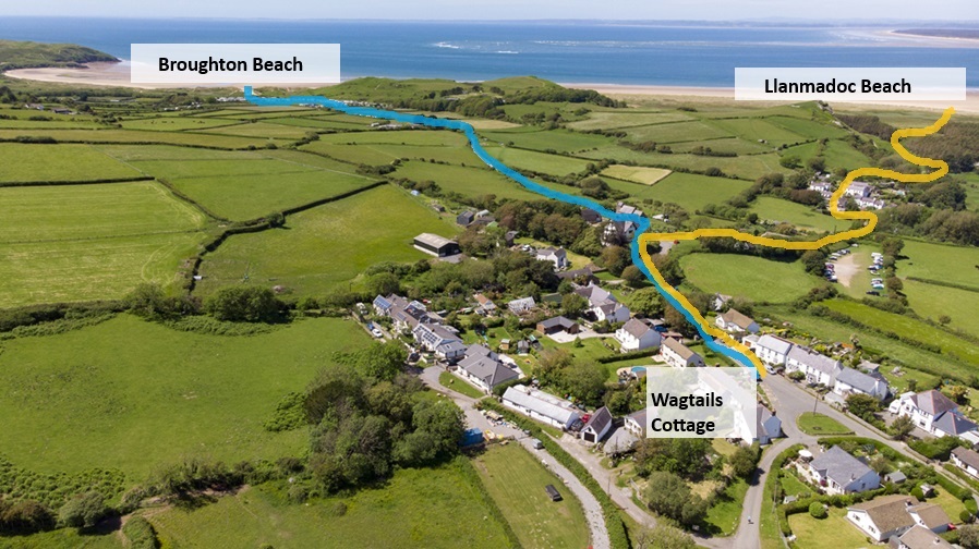
The two Main routs to the beaches local to Wagtails Cottage are shown in this photo. The blue route takes you to Broughton Beach from which you can either return the same way or walk across the beach north eastwards coming back via the orange route back via Cwm Ivy
This photo has Wagtails and also Heather Cottage shown below and Cwm Ivy Hamlet and the walk down through Cwm Ivy to the Llanmadoc end of the Whiteford Bay. It takes around 20 minutes or if you are a slower walker perhaps 30 minutes to walk down to the beach taking this route. There is another route which we use which would be to the left of this photo down via Whiteford Bay Leisure Park caravan site
This photo has Wagtails and also Middle Cottage and Heather Cottage shown below and Cwm Ivy Hamlet and the walk down through Cwm Ivy to the Llanmadoc end of the Whiteford Bay. It takes around 20 minutes or if you are a slower walker perhaps 30 minutes to walk down to the beach taking this route. There is another route which we use which would be to the left of this photo down via Whiteford Bay Leisure Park caravan site
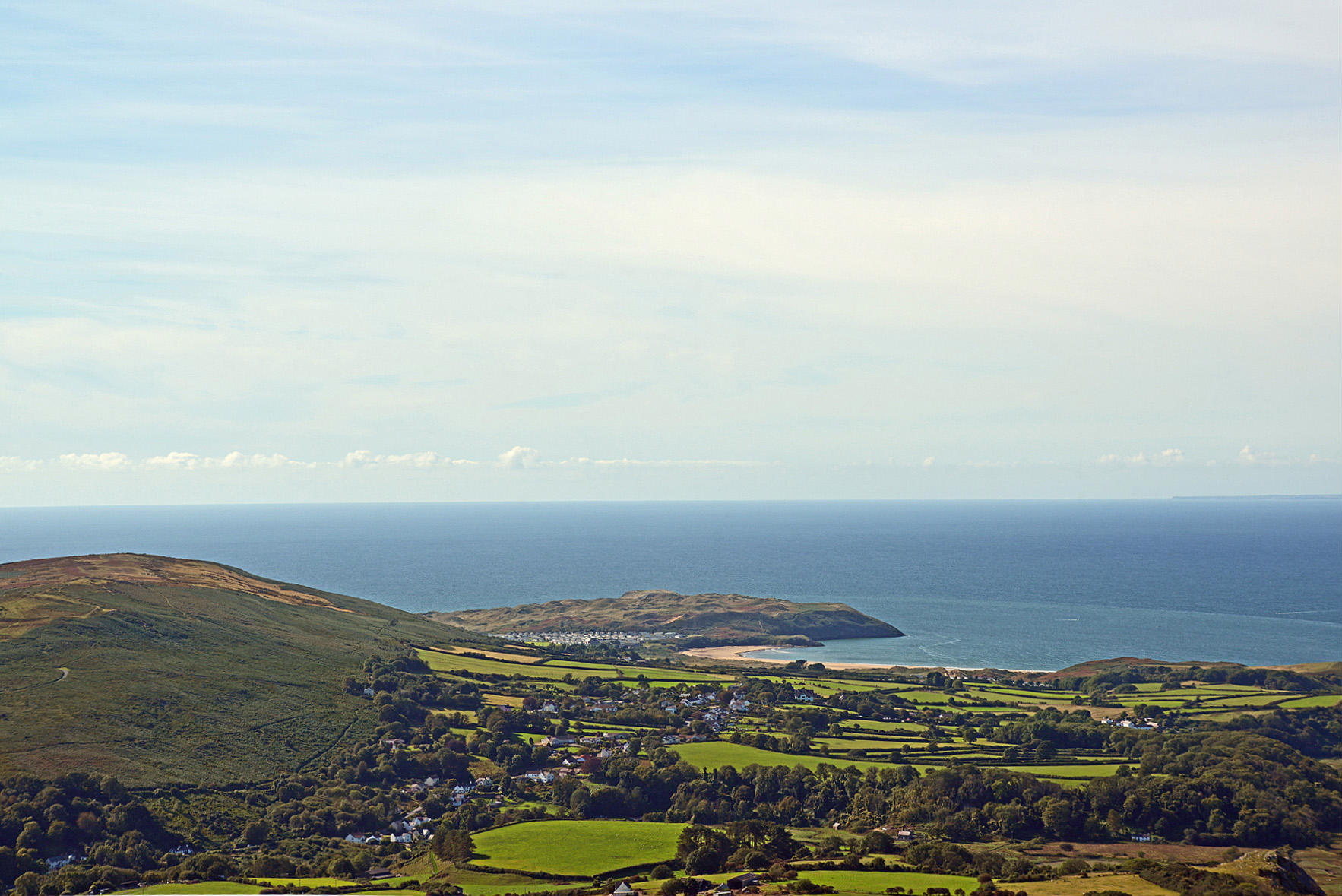
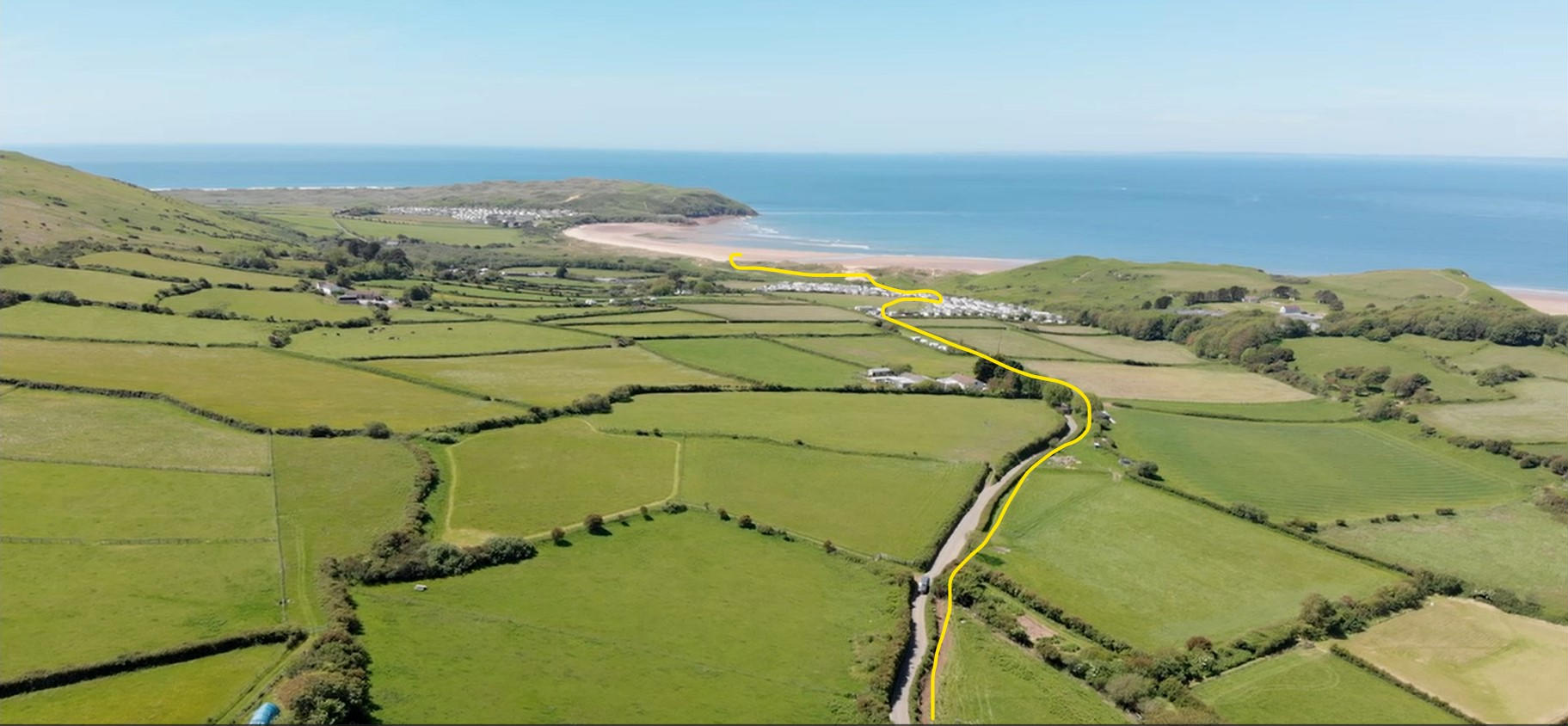
Broughton Bay in background is easily reached by foot from Wagtails. If you walk along the distant headland left it takes you to Burry Holm Island and Rhossili Beach
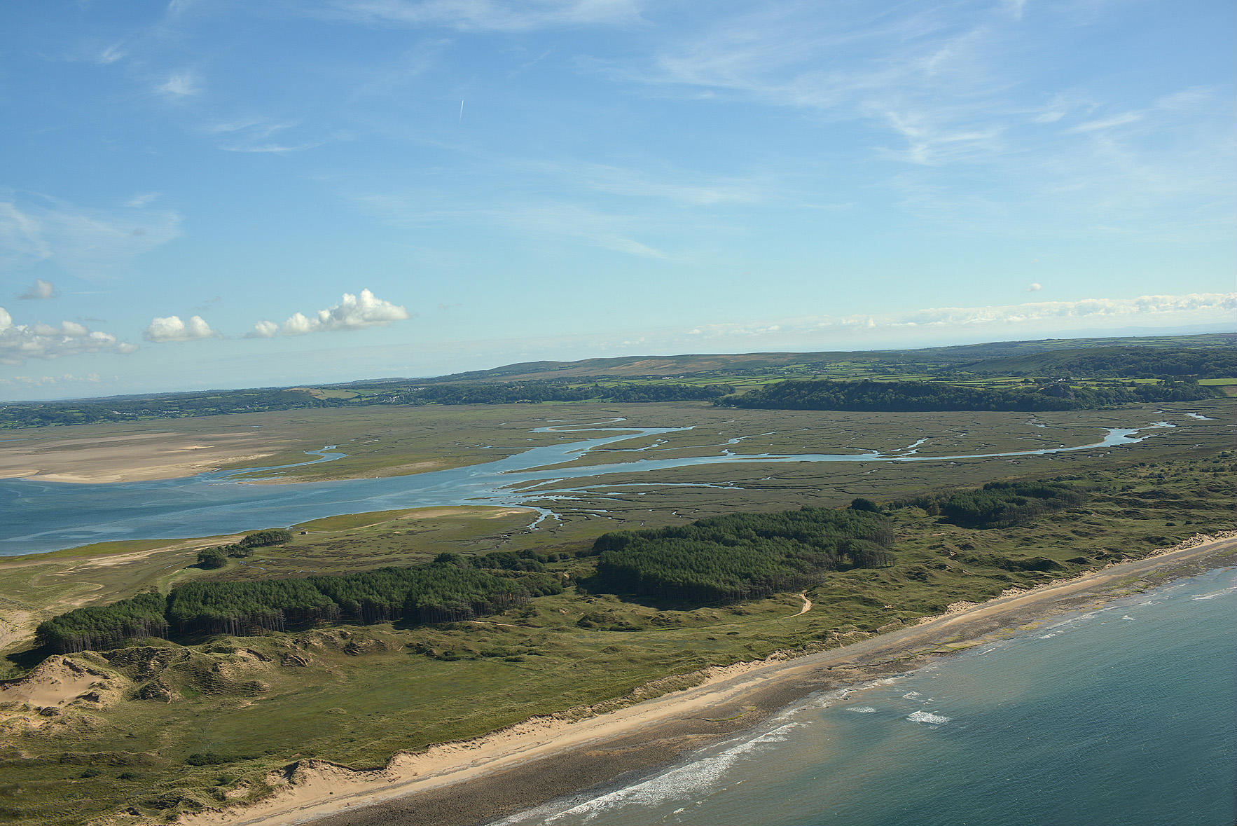
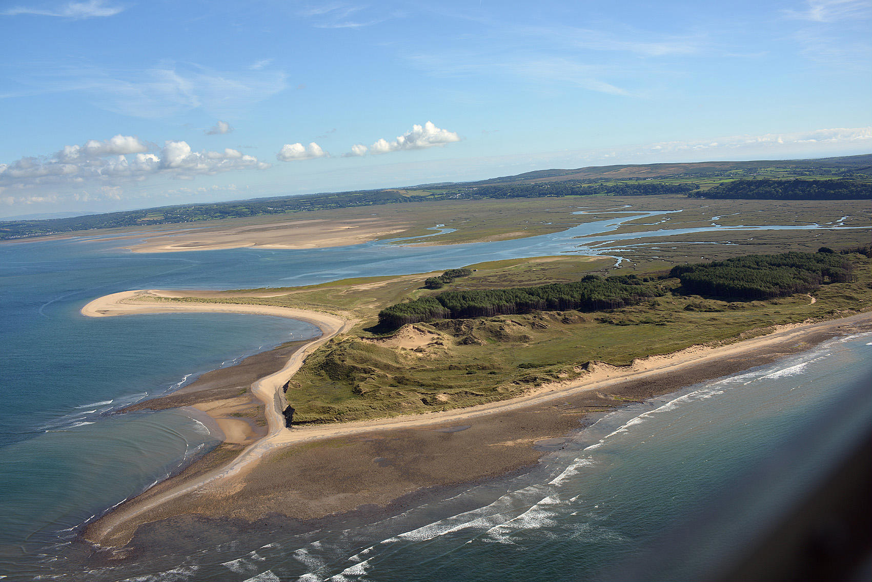
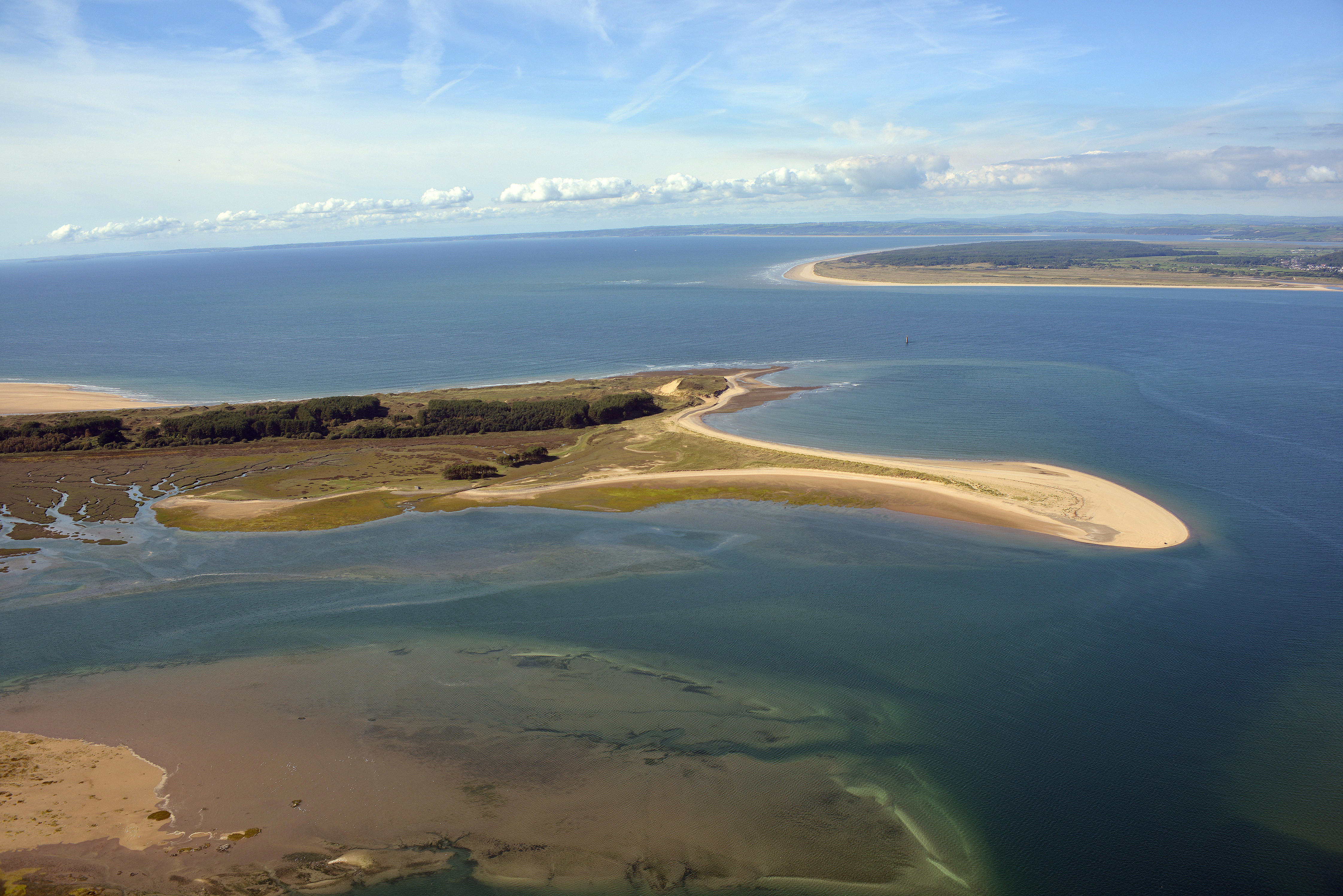
This area is the beach and dune system immediately below our village. It offers some stunning walks on clean sandy beaches either along the shoreline or through the woods and dunes. The photo is taken from above Whiteford Lighthouse by drone pointing roughly east towards Landimore. Llanmadoc would be on the right of the photo and on Llanmadoc Hill. The beach shown is part of Whiteford Bay and stretches 4 miles well out of this image
The tide circulates around Berges Island which is not actually an island. You can walk to this area in around 30 or 40 minutes from Wagtails Cottage.
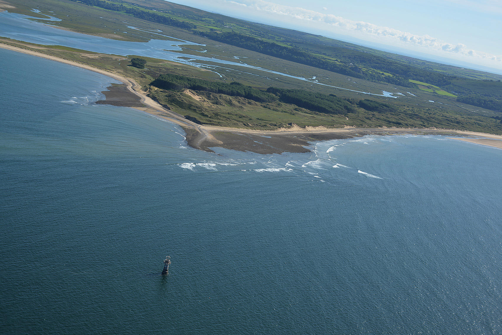
Another Photo of Berges Island and Whiteford Bay with camera pointing south east. This shows Burry Pill which is a middy creek east of Berges Island upstream of the sea. The tide comes in and out here twice daily. Bottom right just out of camera is one stretch of open sandy beach. The beach then stretches 3 miles west towards Broughton Caravan Park. If you like salt water fly fishing or woodland walks or maybe some saltwater marsh and estuary birdwatching this area is full of natural habitats and sealife. The rocks and beach are full of mussels and cockles. The seal patrols the lighthouse area regularly.
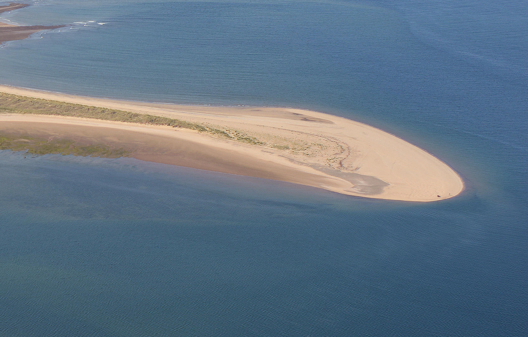
This is the small spit of sand pointing towards Llanelli and Loughor from the north east point off Berges Island. There is a birdhide at this spit. It has pine woods just out of photo into which you can sit in the shade and cool down after an hours walk from Wagtails Cottage it is just a magical walk and location. If you see half a dozen people all day its a busy day
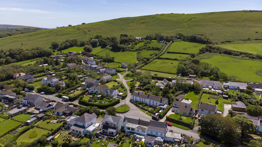
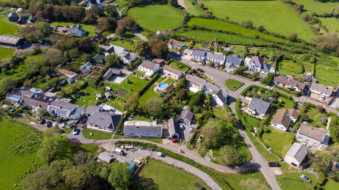
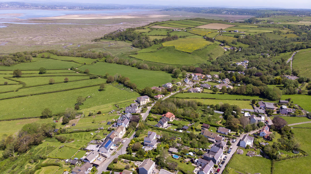
Llanmadoc Village top end with our cottages in the centre on the village top green. The photo faces due south east. Llanmadoc Hill rises above the village and offers a superb high position for breathtaking views after an exhilarating walk. Vilage shop is bottom left in photo. Pub would be out of shot to the left
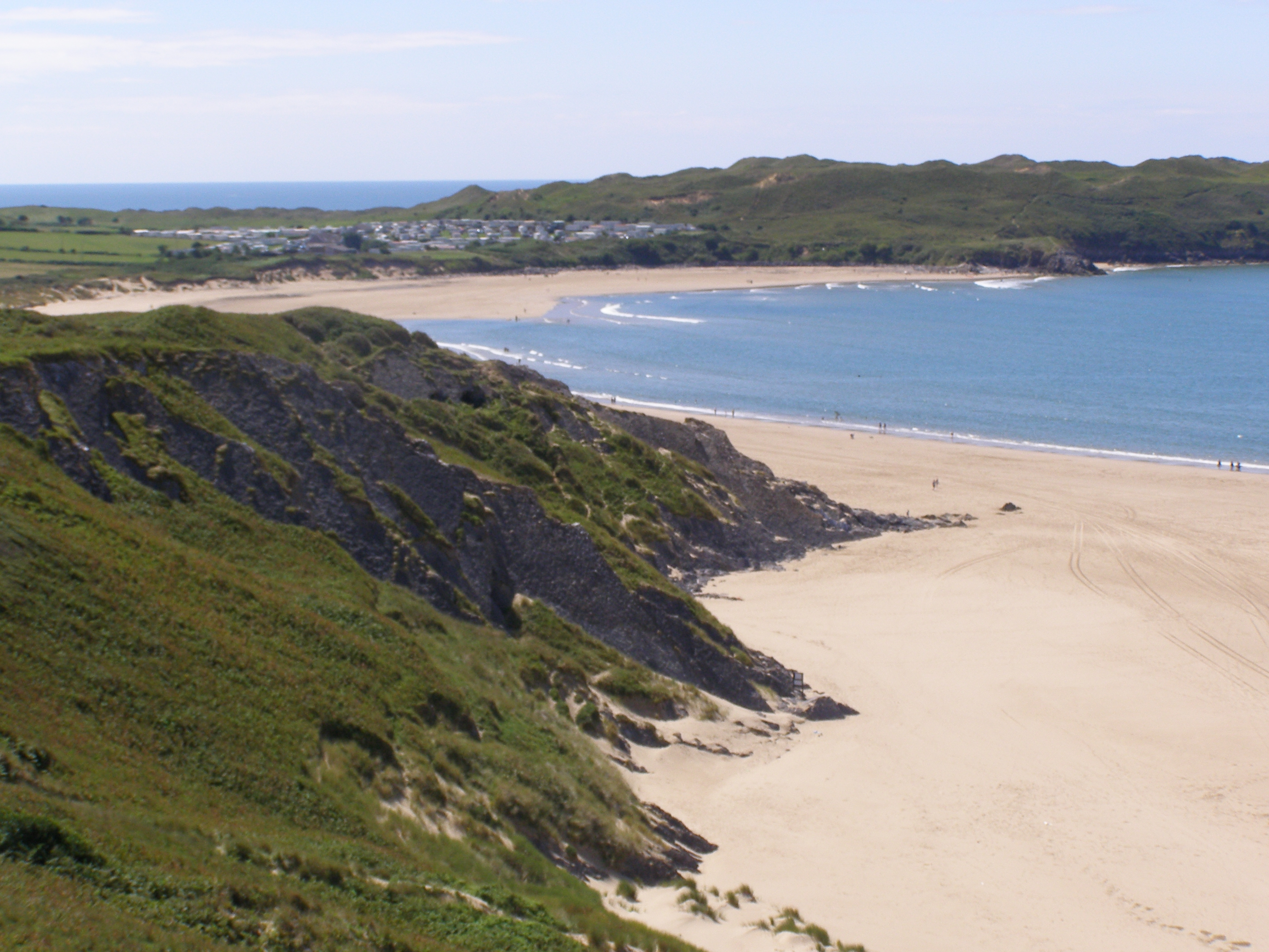
Whiteford Bay shown with Rhossili Beach barely visible in distant extreme top left then Broughton Beach and caravan site shown clearly in top left and Llanmadoc Beach shown in top right. The two beaches of Broughton and Llanmadoc form one bay namely Whiteford Bay and are joined in the middle by high cliff Tors and are only separated at beach level by occasional very high tides. Otherwise you can nearly always walk the entire length most days from BlackRock at Broughton to Berges Island Spit at the other end out of shot and then back through Cwm Ivy Woods and village back up to Wagtails Cottage. St Madoc Church and the Rectory are just in shot bottom right. Cwm Ivy is out of shot to the right which offers a different route down to the beach from Wagtails. The photo is pointing due west. Tenby would be well distant in the background across Carmarthen Bay.
This photo pointing due west shows Berges Island and Whitford Peninsula to the eft and Pembrey Beach aka Cefn Sidan Beach in Carmarthenshire across the sea to the top right. Tenby in Pembrokeshire would be just about visible on a clear day in the distance. This is a good image of how Llanmadoc Beach on the left stretches north towards the estuary and facing west into the open sea. It highlights the incredible beauty of the natural landscapes in north west Gower teeming with birdlife
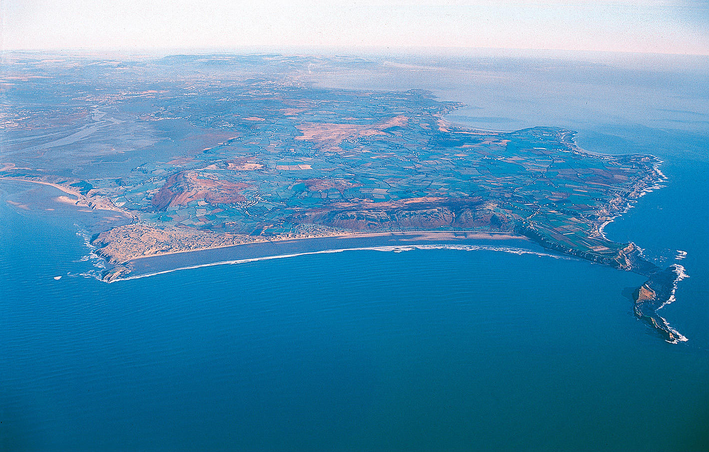
Image shows Worms Head on the right and Burry Holm to the bottom left. Broughton Beach is shown extreme left leading up to Llanmadoc Village which is around quarter of the way from left to right in the photo and roughly half way from top to bottom. Gower is around 16 miles long and around 4 miles wide. Guests at Wagtails Cottage regularly make the full 2hr - 3hr walk from Wagtails to Rhossili Village via Llangennith Village.
Whitford Bay and Llanmadoc Beach with Berges Island to the left and Broughton Beach to the right with Worms Head in very distant background top right. Llanmadoc Hill shown too. Notice the high tide filling the Pill to the top left of the photo this Pill runs right up to the bottom of the Britannia Inn Public House in Llanmadoc Village when full in on a high tide
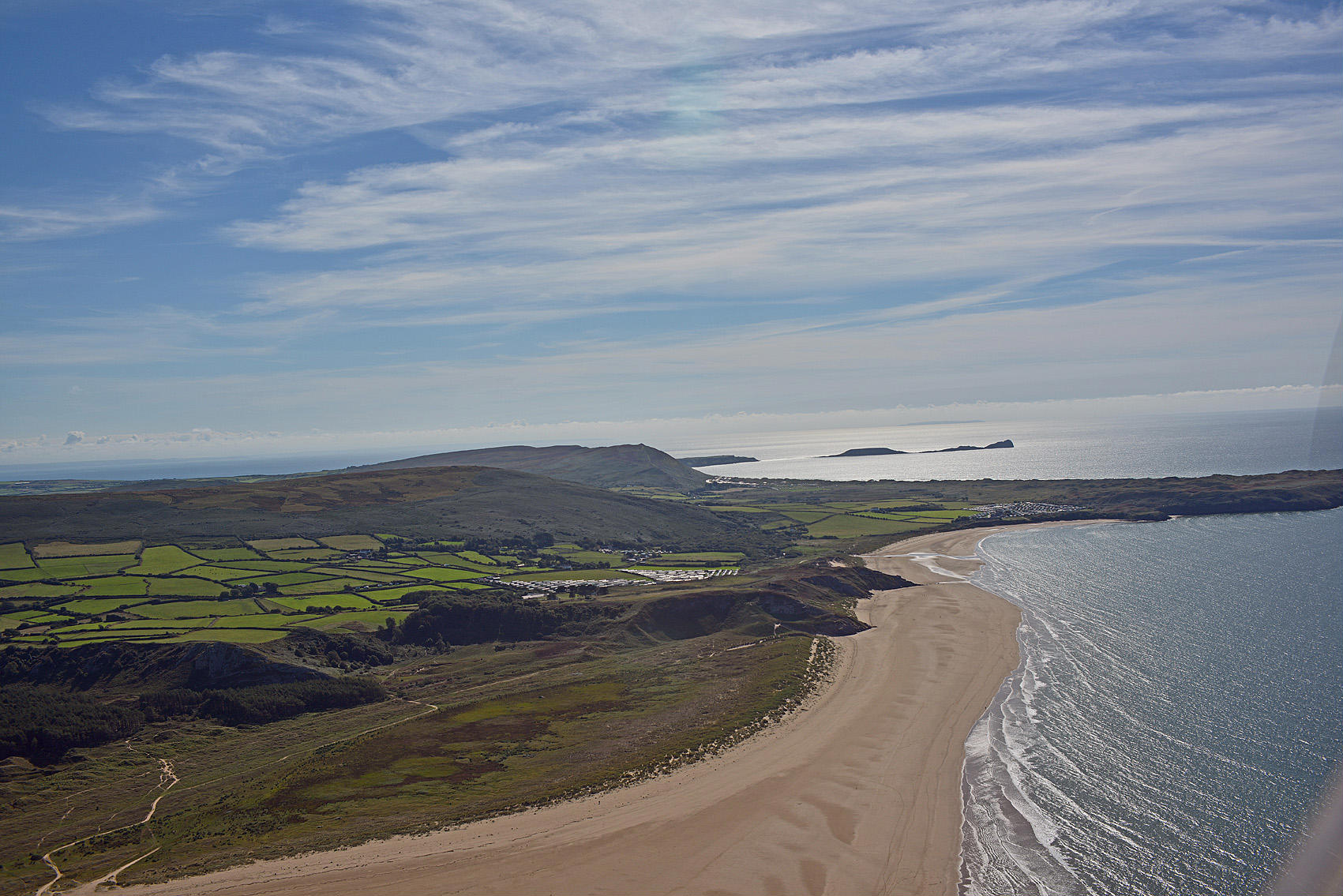
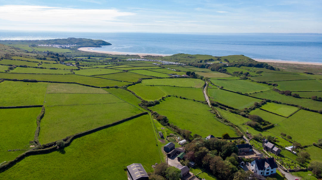
The two beaches and their joining point which only gets cut off and therefore impassible at very high tides. Notice the stream running into Broughton Beach this is the route we take when we walk our dogs from Llanmadoc Village. Thee two caravan sites are shown namely Whiteford Bay Leisure Park in foreground and you can also make out Broughton Caravan Park to the right above Broughton Beach and directly under the Worms Head in distance
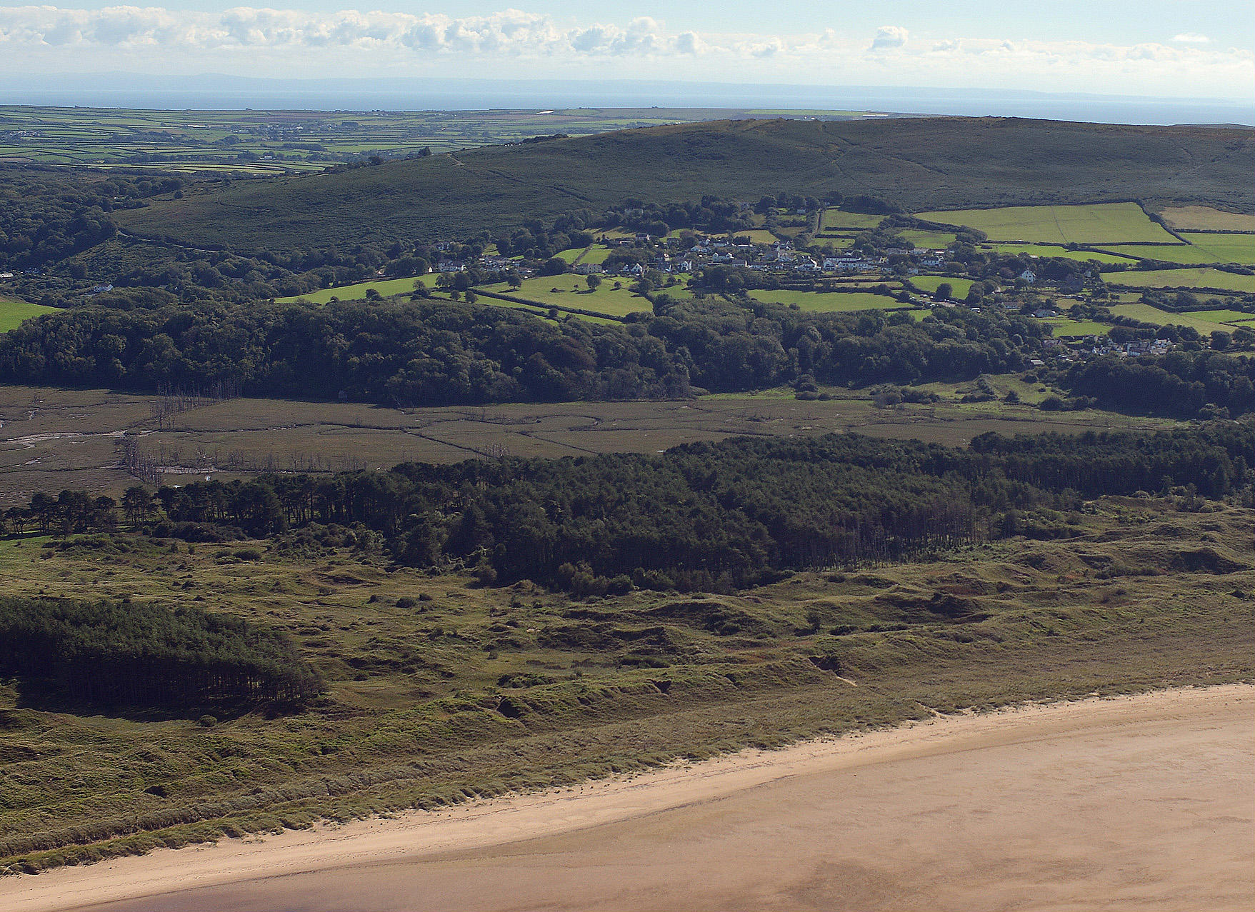
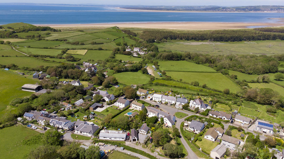
Photo of Llanmadoc Village and its beach taken from above Whiteford Sands with Berges Island to the left and Cwm Ivy Woods in the foreground

Shows Broughton and Llanmadoc Village photo pointing west

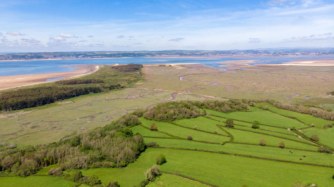
Great angle pointing south east to show Berges Island and Cwm Ivy Woods. Llanrhidian Marshes are shown clearly.
Taken from a drone above Llanmadoc Village facing west to north west